Sunday 5 June 2011

Citations

Here is a list of all the sites and books that I used.
foundlocally.com
www.traveljournals.net
http://en.db-city.com/
http://members.shaw.ca/kcic1/geographic.html
www.livingin-canada.com
http://canadianbiodiversity.mcgill.ca
maps.google.ca
http://www.halifaxnovascotiarealestate.ca/Industry.asp
http://halifaxtourism.ca/attractions/
http://www.maplandia.com
http://exploredia.com
http://atlas.nrcan.gc.ca
www.mcgill.ca
www.mapsofworld.com
www.edmonton.ca
ww.travelmath.com
http://www.quora.com
http://www.roadsidethoughts.com
http://www.worldweather.org
http://www.trailcanada.com
http://www.climatetemp.info
http://www.canadianimmigrant.ca
http://www.vancouverinfocenter.com/
http://www.vancouverattractions.com
http://www.digitalartschool.com/campuses/halifax
http://www.novascotia.com
http://www.kevinwong.ca
http://wikipedia.org
http://tripadvisor.ca
http://nsonline.com
learningfreely.net
http://www.go-montreal.com
Making Connections: Canada's Geography, 2nd Edition
trusted Author Team: Bruce Clark, John Wallace and Kim Earle, 2005
http://www.ec.gc.ca
http://www.aaha.ch
http://investinspaininfo.org/
http://www.paultownend.com
http://www.panoramio.com
http://www.arch.mcgill.ca
http://www.mapsofworld.com
http://canadaonline.about.com
http://palter.ca
http://www.edmonton-hotels.org/
http://www.calgaryherald.com
http://twotourism.com
http://www.yagotta.ca
gonomad.com
tripadvisor.com
http://www.hellobc.com
http://vancouver.ca
http://www.capbridge.com/
richardmorrison.ca
http://www.travelpod.com
http://www.znzlimo.com
vancouver-whistler-canada.com
http://jnweb.com

End of Family Trip

Wow. That was quick. Just found out that Canada is a beautiful place that we should appreciate a bit more. This road trip was a great adventure, and I learned lots about our amazing country.
Go Canada!

VANCOUVER

I am in what is probably one of the most scenic cities in the world. Vancouver, British Columbia is right by the great Pacific Ocean. There are a lot of things to do in Vancouver. First, we went to the gigantic Vancouver Aquarium, which has over 70,000 creatures in it. Wow! It took us about 4 hours to walk through. The best part was looking at the menacing sharks. Then, we went to have a picnic in Stanley Park, Vancouver's equivalent to Central Park in NYC. The size of Stanley Park is 1,000 acres, and it is close to Vancouver's downtown core. We listened to the birds and we even saw a deer! After that, we went to the Capilano Suspension Bridge, Vancouver's best attraction. It was made in 1889 and it 137m long and it is 70m high. Talk about being afraid of heights and bridges at the same time! You can feel the treetops and observe the coastal forest from a squirrel's point of view. It was a once-in-a-lifetime experience that I'll never forget.

Here are some facts about Vancouver:
LATITUDE AND LONGITUDE:

49° 15' 0" N / 123° 8' 0" W
POPULATION:
2,000,000
POPULATION DENSITY:
735 people per square km
LANDFORM REGION:
Western Cordillera
CLIMATE:
July average temp. high 22°C, low 13°C, average month temp. 17°C. average precipitation in July is 36mm
ECOZONE:
Pacific Maritime
CLOSEST NATIONAL PARK:
Gulf Islands National Park
INDUSTRIES:
Fishing, commerce, logging
TOURISM:
Pacific Ocean, Recreation, Stanley Park, Vancouver Aquarium, Capilano Suspension Bridge, Coast Mountains

Here are some pictures:
Vancouver skyline
Vancouver air view
Vancouver's Lions Gate Bridge
Capilano Suspension Bridge
Stanley Park air view
vancouver map
Vancouver map
British Columbia Map

Yellowknife

Here we are at our second last stop; Yellowknife. On the north shores of beautiful Great Slave Lake, it might seem like the middle of nowhere, but it isn't. Yellowknife is a fantastic place. We took boat tour of the scenic Great Slave Lake, we went on many fishing adventures in all of the many lakes nearby, and we saw the beautiful Cameron River Ramparts, which is like a waterfall and rapids combined. The roar of the water is almost as loud as Niagara Falls! We also walked on what was probably the best hiking trail that I've ever been on. It is called the "Cameron River Falls Trail", and hikers that walked it would be rewarded with a 17m waterfall. It was very majestic.We also learned many cool things about Yellowknife. Did you know that it is the only city in the North West Territories? And if not for the discovery of gold, Yellowknife would not even exist!

Here are some facts about Yellowknife:
LATITUDE AND LONGITUDE:
62° 27' 0" N / 114° 21' 0" W
POPULATION:
20,000
POPULATION DENSITY:
460.3 people per square km
LANDFORM REGION:
Canadian Shield
CLIMATE:
July average temps. are 21°C high and 12°C low with the average temp. being 16.5°C. The average precipitation is 35mm
ECOZONE:
Taiga Shield
CLOSEST NATIONAL PARK:
Wood Buffalo National Park
INDUSTRIES:
Mining, recreation
TOURISM: Northern Lights, recreation, Great Slave Lake, Cameron River


Here are some pictures:
y
Yellowknife from air

Yellowknife from air

Northern Lights

Cameron River Ramparts

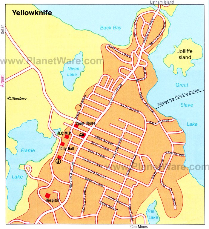
Yellowknife map

NWT Map

Third Stop, Edmonton!

3,588 km. That's how long it took to get from Montreal to Edmonton! That was a rough drive. But here I am, in the provincial capital of Alberta, where cowboys are. So far, Edmonton has been great! So far, we've been getting our exercise by going to the many parks here. We also went to the LARGEST mall in the world! The  West Edmonton Mall is enormous. It's 48 city blocks, and it has the: World's largest indoor amusement park,
World's largest indoor triple loop rollercoaster, World's largest indoor lake, World's largest indoor wavepool, and the World's largest indoor permanent bungee tower. Isn't that just amazing? We also went to the Edmonton Valley Zoo, which is home to over 350 animals from different climates and habitats. After that, we went to the Muttart Conservatory, which has probably the most beautifulest flowers in the world and probably the most beautifulest iconic man-made glass pyramids in the world too. Edmonton may be cold and dreary in the winter, but it is a nice place to visit in the summer!


Here is some information about Edmonton:
LATITUDE AND LONGITUDE:

53°30'N
11°30'W
POPULATION:
782,500
POPULATION DENSITY:
109.9 per square km
LANDFORM REGION:
Interior Plains
CLIMATE:
In the month of July, the average high temp. is 24°C and low temp. 11°C with an average temp. of 17.5°C. The average precipitation is 82mm.
ECOZONE:
Boreal Plains
CLOSEST NATIONAL PARK:
Elk Island National Park
INDUSTRIES: 
Manufacturing, agriculture
TOURISM:
Recreation, West Edmonton Mall, Muttart Conservatory

Here are some pictures:
Edmonton skyline
 Edmonton skyline
Muttart Conservatory
West Edmonton Mall

Edmonton map

Map of Alberta

Next Stop: Montreal

Bonjour tout le monde!
I'm in La Belle Province, Quebec, in wonderful Montreal! The culture is so amazing here! Too bad I didn't take extended French, because then I would be able to talk to everyone here. All I can say is "Bonjour!" and "Comme ca va?". And did you know that Montreal is basically an island? Amazing! Anyways, this place has been awesome so far. We walked around, listening to french conversations and trying to read stuff in french. We walked along the mighty St. Lawrence River, and we walked on Mont-Royal to get a beautiful picture of Montreal. We also went whitewater rafting! I know, how can you go whitewater rafting in Montreal? Well, its actually on the St. Lawrence River. They're called the Lachine Rapids, and it was a very fun experience. We were soaked from head-to-toe. It was a wet, wild adventure. The next day, we visited the unique, sphere-shaped building that is the First Canadian Environment Museum. It was amazing to look at the magnificent architectural features of the building. Once we got inside, we saw different environmentally-friendly power sources like wind turbines, and we saw many educational exhibits. Montreal was a blast!

Here is some information about Montreal:
Latitude and Longitude:

45° 30' 0" North, 73° 35' 0" West
Population:
3,316,615
Population Density:
854 People per square km.
Landform Region:
St. Lawrence Lowlands
Climate:
For July: average high temp. of 26°C and low temp. of 17°C. Average temp. is 21°C. Average precipitation is 98mm
Ecozone Region:
Mixedwood Plains
Closest National Park:
Îles-de-Boucherville National Park
Industries:
aerospace industry, commerce, agriculture
Tourism:
Professional sports, St. Lawrence River, cuisine, french culture

Here are some pictures:
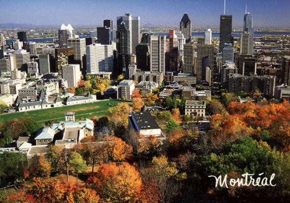
Montreal skyline
Montreal and the St. Lawrence River
First Canadian Environment Museum
Lachine Rapids
Mont-Royal, Montreal
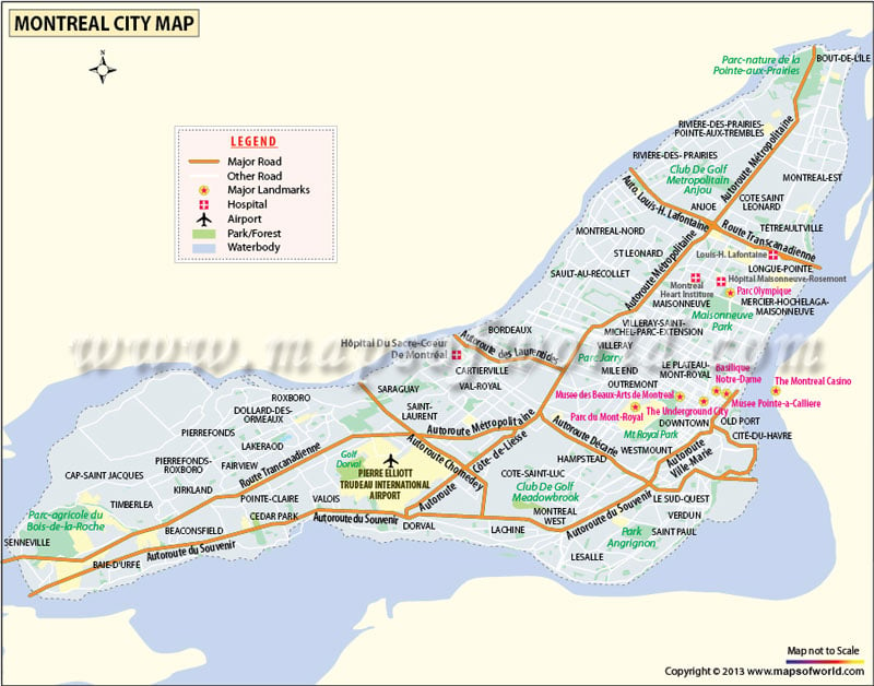
Map of Montreal
Map of La Belle Province, Quebec

First Stop: Halifax

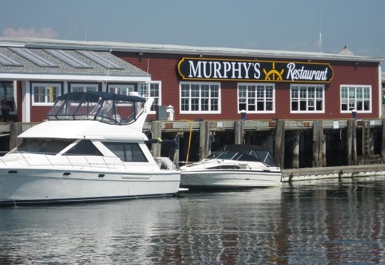
After a looooooong day of driving, we finally arrived at Nova Scotia's provincial capital, Halifax. The next day we did all sorts of things. We touched the Atlantic Ocean, and I gladly pushed my little sister into the water by "accident". We then went to restaurant call "Murphy's On The Water" which is the largest restaurant on a boat in the world! After a satisfying meal of lobster and fries,we visited the Halifax Citadel, a wonderful place of history that symbolizes Britain's military supremacy. We could heard the cannons firing, and echoes of a war to control Canada. We also enjoyed the Maritime Museum of the Atlantic Ocean. We saw many different kinds of ships there, from a modern day battle cruiser warship, to a small schooner. We also went to Peggy's Cove, and we gazed out to sea, imagining the shores of Great Britain from here.

Halifax is a great place. Everyone there is happy, the weather is so nice, and the ocean is mesmerizing. The food is great, (especially the lobster), and the lifestyle better.  We had a great time in Halifax.

Here is some information on Halifax:
Latitude and Longitude:

44° 38' 60 N 63° 36' 0 W
Population:
400,000
Population Density:
67.9 people per square km.
Landform Region:
Appalachians (very hilly)
Climate:
In the month of July, the max temp. is 23°C and the low temp. is 13°C. The average temp. is 13°C. The average precipitation for July is 97mm.
Ecozone:
Atlantic Maritime
Closest National Park:
Kejimkujik National Park
Industries:
Commerce  fishing, agriculture, mining, forestry
Tourism:
Recreation, Atlantic Ocean, Halifax Citadel

Here are some pictures of Halifax:
Halifax skyline
Halifax Citadel
Harbor at Night
Boardwalk in Halifax
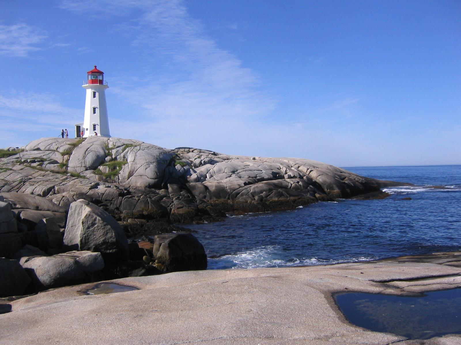
Peggy's Cove
Murphy's-On-The-Water Restaurant
Map of Halifax
Map of Nova Scotia